Updates & Blog
Fall 2025 Wildfire Outlook: Southern States Face Elevated Fire Risk as La Niña Strengthens
As fall settles across the South, wildland fire managers are preparing for what could be a highly active period of wildfire activity. According to the Southern Area Wildfire Risk Assessment (Fall 2025), conditions are aligning for above-average wildfire potential through the end of the year. A combination of persistent drought, abundant dry vegetation and the development of La Niña is setting the stage for challenging months ahead.
Understanding Southern Wildfire Activity
The Southern Region, which spans from Texas to Virginia, typically experiences two distinct periods of increased wildfire activity: one in the spring and another in the fall. While humid summer weather usually suppresses major wildfire events, late-summer dryness often predicts how severe fall wildfire activity will be. This year, widespread rainfall deficits have taken hold across much of the region, with many areas receiving 30-50% below normal precipitation since August.
The expected shift to La Niña conditions (a recurring pattern that brings warmer, drier weather to the southern U.S.) means this dryness will likely persist through winter. In some previous years, tropical systems have brought temporary rainfall relief to parts of the South. However, this year’s limited tropical activity has offered little moisture. As a result, dryness and elevated wildfire risk have continued to expand across the Gulf States, Appalachians and Piedmont.
The Forecast: Elevated Wildfire Risk Through Winter

The risk assessment identifies the most likely outcome for the months ahead as one characterized by above-normal wildfire activity across much of the Southern Region. Several factors are converging to create this scenario:
- Dry vegetation such as grasses and fallen leaves are becoming increasingly flammable across the South, especially in Texas and Oklahoma. Spring rains produced abundant grass growth that has now “cured” (dried out completely), creating a carpet of ready fuel for wildfire to burn.
- Drought-stressed pine forests and beetle-killed stands along the Gulf Coast add dangerous fuel loads. The Keetch-Byram Drought Index (KBDI), which measures how dry soil and vegetation are on a scale of 0-800, is showing values above 600 across much of the region, indicating both the ground and surface fuels are critically dry.
- Hurricane Helene’s aftermath has created especially volatile conditions across the Southern Appalachians. When the Category 4 storm tore through the northeast portion of the region, hurricane-force winds toppled millions of trees. That timber has now fully dried out over the past three weeks, creating vast areas of hazardous fuel that could burn intensely and be particularly challenging for wildland firefighters.
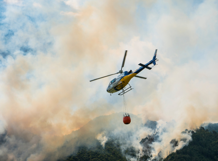
This combination means wildfires could start easily from a single spark, spread rapidly across landscapes and prove difficult to control. With leaf fall now underway and limited rainfall in the forecast, multiple parts of the Southern Region could see significant wildfire activity at the same time—stretching wildland firefighting resources thin across multiple states.
What La Niña Means for Wildfire Activity
NOAA officially declared La Niña conditions in early October, signaling a pattern of above-average temperatures and below-average rainfall across the southern U.S. This marks a “double-dip La Niña,” meaning La Niña conditions have returned for a second consecutive year after a brief break. This kind of pattern historically correlates with heightened wildfire activity. Similar double-dip events in 1999, 2011 and 2021 all brought periods of heightened wildfire activity to the South.
Although late-season tropical systems remain possible through November, forecasters say the odds of significant rainfall relief are low. October is already one of the driest months in the region, and the outlook for November points to continued dryness and above-average warmth from Texas through the Carolinas.
Regional Concerns at a Glance

- Texas & Oklahoma: Abundant grass growth from a wet spring has cured into a continuous carpet of flammable vegetation. Even moderate winds could trigger large, fast-moving grass fires that threaten rural communities and rangeland.
- Gulf Coastal Plain: KBDI values between 600-700 indicate severe drought stress in pine forests. Combined with low moisture levels in living plants, this creates conditions where wildfires can burn intensely through both surface fuels and forest canopies (i.e., ground level vegetation and tree tops).
- Southern Appalachians: An estimated 800,000+ acres of downed and broken trees from Hurricane Helene is creating especially dangerous conditions with potential high resistance to control efforts. Degraded road access also complicates response operations.
- Piedmont & Carolinas: Rainfall deficits of 4-8 inches since August and early leaf fall are driving increased potential for rapid wildfire spread through mixed hardwood forests and suburban wildland interfaces (i.e., Wildland Urban Interface).
What This Means for Communities
Residents across the Southern Area should take this elevated wildfire risk seriously:
- Stay informed about local fire weather conditions and any burn bans in your area
- Create defensible space around homes by clearing leaves, dead vegetation, and debris within 30 feet of structures
- Never burn yard waste on windy days or during drought conditions. Even small debris piles can escape control
- Have an evacuation plan ready if you live in or near forested or natural areas
- Report smoke or wildfires immediately by calling 911 or your local state forestry office.
For wildland fire managers and wildland firefighting agencies, preparedness is critical. Expect extreme wildfire behavior where drought indices exceed the 97th percentile. Monitor days-since-rainfall closely, especially following leaf drop. Anticipate prolonged mop-up operations and potential for reburns in drought zones. In Helene-impacted forests, indirect tactics and heavy equipment may be necessary due to hazardous fuels and degraded access.
Updated spatial data from LANDFIRE and EFETAC’s HiForm project are available to help guide planning and mapping in affected regions.
Looking Ahead
With La Niña expected to persist into spring 2026, the Southern Region could face an extended period of heightened wildfire risk. Wildland fire managers across federal, state and local agencies are coordinating resources and sharing situational awareness to prepare for potential simultaneous wildfire activity across multiple states.
For residents, this is a time for vigilance and preparation. By understanding the risks and taking simple precautions, communities can help reduce the threat of destructive wildfires this fall and winter.
For the latest updates, fire restrictions, and predictive services, visit websites provided by. your local state forestry agency, the Southern Area Coordination Center (SACC) and the National Interagency Fire Center (NIFC).