Updates & Blog
The American South’s Wildfire Revolution: Innovation, Training and Collaboration
Wildfire activity across the South has been significant this spring, with conditions reflecting a sustained and active fire environment across the region. State forestry agencies have reported thousands of new fires in recent weeks. The heightened wildfire activity in the South is being driven by dry vegetation (fuels), seasonal weather patterns and the reality that, in the South, wildfire risk is a year-round challenge. Outlooks currently show above-normal wildfire potential continuing through late spring and into early summer, signaling that elevated conditions are likely to persist and intensify.
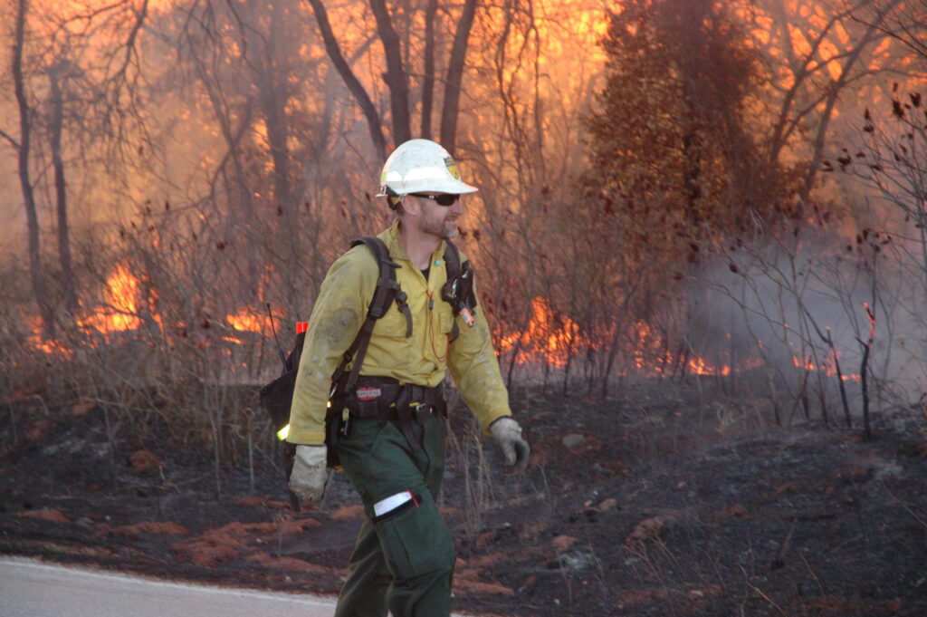
And yet, when it comes to wildfire response, the Southern Region may not always grab the biggest headlines. Behind the scenes, however, southern state forestry agencies and their partners are leading a quiet revolution in wildfire innovation, reshaping how the nation approaches suppression, prescribed fire and wildland firefighter safety. From advanced drone operations to cutting-edge training programs and collaborative partnerships, the South is building America’s future in wildfire management.
Innovation and Technology Taking Flight
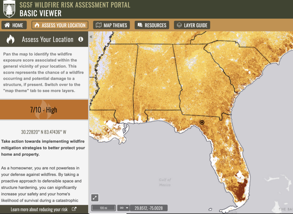
The Southern United States is a hub of technological innovation and collaborative wildland fire management, grounded in a deep-rooted regional commitment to mutual support and a collective responsibility for the region’s forests and communities. Regional initiatives like SouthWRAP (Southern Wildfire Risk Assessment Portal) highlight how southern states are harnessing geospatial technology and data-sharing platforms to modernize how firefighters, agencies, communities and landowners assess risk, mitigate and manage wildland fire activity at scale.
This spirit of innovation is inseparable from the South’s broader culture of collaboration. Through its compact agreement systems and mutual aid frameworks, southern states routinely deploy resources across state lines, sending crews, equipment and expertise to support neighbors during extreme wildfire emergencies and recovery efforts.
The below examples represent just a fraction of the innovations lead by southern states that make the South a national model for successful wildland fire management.
Alabama: Leveraging NASA’s Remote Sensing Technology
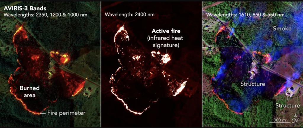
The Alabama Forestry Commission has increasingly benefited from advanced airborne remote-sensing technologies used to support wildfire response and mapping. NASA’s AVIRIS-3 airborne imaging spectrometer has been deployed on active wildfires in Alabama, providing near-real-time data on fire perimeters, intensity, and behavior. This kind of high-resolution infrared and visible imagery allows responders to better understand fire extent and prioritize suppression actions more quickly than ground observation alone.
Arkansas: Strengthening Wildfire Response Through Rural Partnerships
The Arkansas Department of Agriculture’s Forestry Division is strengthening wildfire response capacity by equipping rural volunteer fire departments with specialized wildland fire suppression kits. Through support from the U.S. Forest Service Volunteer Fire Assistance Grant program, the state continues to expand access to critical equipment designed specifically for wildland firefighting.
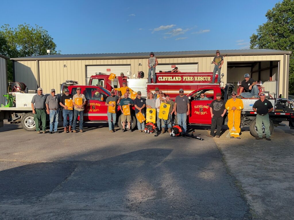
Each kit includes essential gear such as wildfire-resistant coveralls, gloves, hand tools, backpack water pumps and leaf blowers, giving partner responders the equipment needed to more safely and effectively support wildfire response. Since the program began in 2014, more than 800 kits have been distributed to volunteer departments across Arkansas, significantly expanding local wildfire response capabilities in rural communities. Because volunteer fire departments often serve as the first line of defense during wildfires, the program helps ensure these local partners are better equipped to respond quickly and work safely alongside Forestry Division crews. By investing in equipment, training, and strong partnerships with rural responders, Arkansas is strengthening the state’s overall wildfire response network and improving protection for communities and forest resources
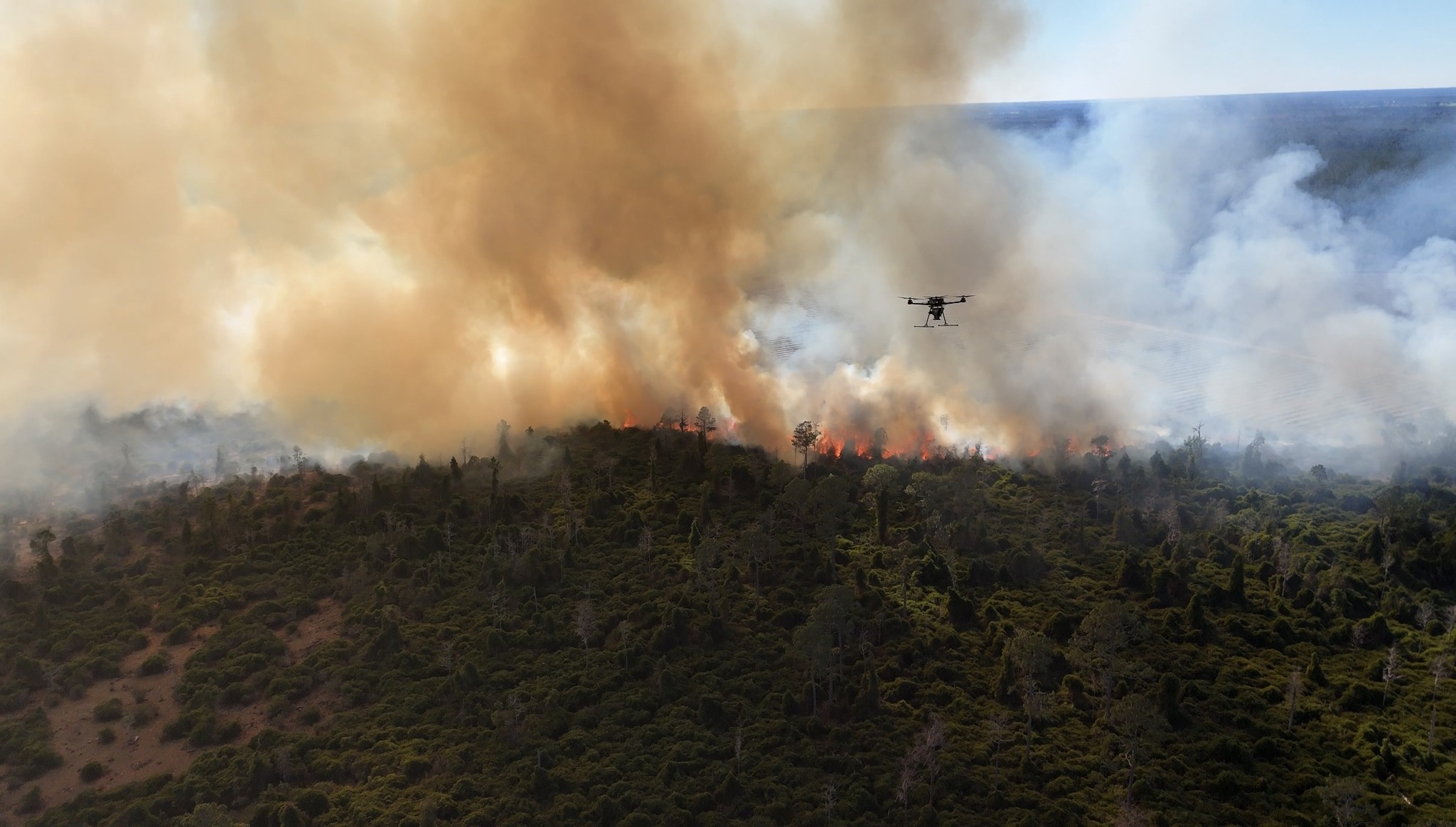
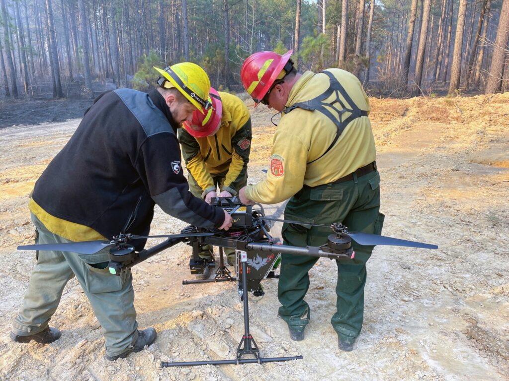
Florida: Expanding Wildfire Operations with Unmanned Aircraft Systems
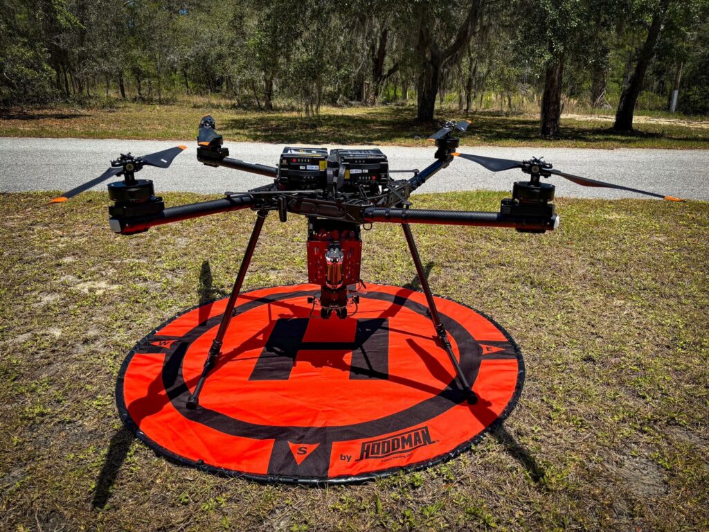
The Florida Forest Service has rapidly expanded its unmanned aircraft systems (UAS) program, building one of the largest operational drone fleets among state forestry agencies. In 2025 alone, the agency deployed 44 quadcopter drones operated by 50 trained pilots who complete specialized UAS training and task book certification through an agency-developed operations course.
These aircraft support a wide range of missions, including wildfire response, prescribed fire operations, hurricane damage assessments, search and rescue missions, and forest resource management. The program also plays a growing role in aerial ignition, with crews deploying more than 30,000 ignition spheres during prescribed burns and wildfire operations. In 2025, drones were used to conduct approximately 180 aerial ignition flights that helped safely burn nearly 18,000 acres, along with additional flights supporting active wildfire suppression and monitoring.
Florida is also helping expand UAS capabilities across the country by assisting other states in developing drone programs and obtaining the federal waivers required for aerial ignition operations. As part of that effort, the agency has developed deployable UAS modules that can be requested by partner states, consisting of trained crews, a mobile command trailer, and multiple drones equipped for aerial ignition, hotspot detection, and advanced fireline mapping. These mobile teams demonstrate how unmanned aircraft technology is transforming wildfire operations while strengthening collaboration across the Southern region.
Georgia: Strengthening Communications Through Interoperability
The Georgia Forestry Commission has modernized its communications by unifying traditional land mobile radio with Southern Linc’s CriticalLinc™ LTE network. This upgrade allows firefighters and foresters to communicate seamlessly with emergency partners across the state using a single, L3Harris® interoperable device. By bridging the gap between legacy systems and broadband, field crews now have reliable coverage even in Georgia’s most remote forestlands. This connectivity ensures faster, more coordinated responses during critical wildfires and natural disasters. Ultimately, this high-tech backbone creates a safer environment for our crews and a more resilient Georgia.
Kentucky: Modernizing Prescribed Fire Coordination
The Kentucky Division of Forestry is partnering with Technosylva to develop a new prescribed fire module and historical burn database designed to improve coordination and situational awareness across the Commonwealth. Expected to launch in 2026, the system will serve as a statewide 24-hour notification platform for prescribed fire practitioners, allowing agencies and land managers to document and track planned burns in real time. The platform will also integrate with Kentucky’s wildland fire computer-aided dispatch (CAD) system, automatically displaying active prescribed burns for dispatch centers, aerial observers, and field personnel. By linking prescribed fire planning with operational awareness tools, Kentucky is using technology to ensure that prescribed burning can be conducted safely and efficiently while improving coordination among firefighters, land managers, and emergency responders.
Louisiana: Scaling Response Through Regional Coordination and Advanced Operations
Louisiana’s wildfire landscape is evolving. In recent years, longer dry periods combined with heavy fuel loads from hurricane-damaged timber have created fire conditions that are becoming more intense and persistent than what the state historically faced. During the severe 2023 wildfire season, crews encountered rapidly spreading fires and reburn issues that required sustained suppression and constant monitoring. The Louisiana Department of Agriculture and Forestry responded by activating an incident management team in Baton Rouge, expanding aerial patrol and detection flights, and leveraging the Southern Wildfire Compact to rapidly bring in strike teams and specialized resources from partner states. Drawing on experience gained from assisting other states during major wildfire events, Louisiana is strengthening its operational approach to manage a more complex fire environment while continuing to protect communities and forest resources.
Mississippi: Modernizing Prescribed Fire Permitting
The Mississippi Forestry Commission has modernized how landowners obtain burn permits by launching a new online permitting system designed to streamline the process while strengthening safety and coordination around prescribed fire. The digital platform allows landowners to quickly apply for forestry and agricultural burn permits while automatically integrating daily fire weather forecasts from National Weather Service offices across the region.
Beyond improving convenience, the system enhances situational awareness for emergency responders and the public. An interactive map of active burn permits allows first responders to confirm authorized burns before responding to smoke reports, helping reduce unnecessary dispatches while ensuring rapid response if a fire escapes. By moving the permitting process online and integrating real-time weather data, Mississippi is using technology to make prescribed fire safer, more efficient and easier for landowners to implement as a critical forest management tool.
North Carolina: Enhancing Community Wildfire Planning
The North Carolina Forest Service (NCFS) is helping lead the development of a new digital approach to Community Wildfire Protection Plans (CWPPs). In partnership with Texas A&M Forest Service and the State of New Jersey, NCFS is beta testing a Living CWPP platform, an online system developed by the Timmons Group that allows agencies and partners to create, manage and update wildfire protection plans in a shared digital environment.
Unlike traditional static plans, the Living CWPP platform functions as a dynamic database, allowing wildfire mitigation priorities, community risk data and project updates to be revised as conditions change. This approach makes it easier for agencies and cooperators to keep plans current and accessible while improving coordination among wildfire response partners. To support these efforts, the North Carolina Forest Service has also established a new Data and Technology Management Branch to centralize the agency’s growing portfolio of data systems and technology tools. By investing in digital planning infrastructure and data management, North Carolina is strengthening its ability to support wildfire mitigation, planning and coordination across the state.
Oklahoma: Launching a Next-Generation Framework for Wildfire Preparedness and Response
Oklahoma is operationalizing an Integrated Warning Team (IWT) model that brings fire agencies, emergency management and the National Weather Service into a single, shared decision-making framework for wildfire preparedness, detection, response and recovery. Rather than coordinating in parallel, partners operate from a common operating structure focused on protecting life, property and critical infrastructure.
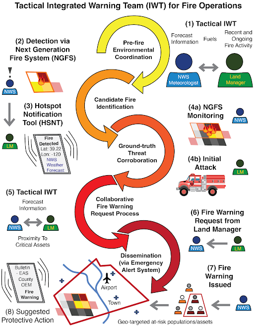
The model integrates satellite-based wildfire detection, including AI-enabled tools, with fire environment analysis that accounts for fuels, weather, topography, and values at risk. Early, georeferenced detection supports targeted response and informs the timely issuance of fire warnings through Emergency Alert System and Wireless Emergency Alerts when warranted. Oklahoma Forestry Services has further strengthened this approach through a Risk-Informed Tool that overlays wildfire spread models with verified data on homes, infrastructure and other values at risk. This ESRI-based dashboard supports strategy-driven initial attack operations, improves situational awareness during active incidents and provides authoritative documentation for Fire Management Assistance Grant requests, reducing administrative burden during life-safety operations.
South Carolina: Deploying Cutting-Edge Fire Detection Technology
South Carolina is piloting advanced fire detection and observation camera systems to improve early wildfire detection in high-risk areas of the state. The camera systems are programmed to conduct continuous 360-degree scans and can monitor areas up to 25 miles away. Using high-powered optical zoom and AI-assisted detection tools, the cameras help fire managers identify potential wildfire ignitions in near-real time. Once a potential ignition is flagged, operators can zoom in, capture imagery and quickly assess whether resources need to be dispatched.
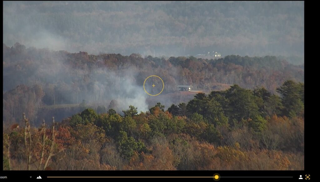
By improving situational awareness and reducing detection time, South Carolina’s use of fire detection cameras demonstrates how targeted technology investments can support faster response, enhance firefighter safety and reduce the risk of small ignitions becoming large, costly wildfires.
To date, two cameras have been installed in the mountainous regions of South Carolina, with a third installation underway and funding secured to purchase three additional units.
Tennessee: Advancing Firewise Innovation from Rural Roots to Citywide Resilience
Tennessee demonstrated early innovation in wildfire resilience through the leadership of the Tennessee Department of Agriculture, Division of Forestry, which helped establish the state’s first Firewise USA® certified city. This important milestone showed that proactive, community-wide wildfire planning could extend beyond rural areas and into more complex municipal environments.
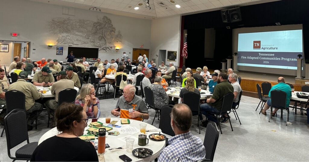
At the time, most Firewise efforts focused on rural communities or homeowner groups, so applying these principles at the municipal level required coordination across local government, emergency services, and residents. By supporting strategies like defensible space, fuel reduction and fire-adapted construction, the Division helped demonstrate how these practices could scale to protect denser populations. The first-of-its-kind effort helped reframe wildfire resilience as a shared, community-wide responsibility, laying the groundwork for broader adoption of fire-adapted practices across the nation.
Texas: Pioneering an Integrated, Interagency Fire Warning System
The Texas A&M Forest Service has played a pioneering role in developing an integrated, interagency fire warning system that fundamentally improves how extreme wildfire threats are anticipated, detected, and communicated. Beginning in partnership with National Weather Service Lubbock offices in West Texas, Texas A&M Forest Service helped establish a collaborative framework that connects advanced fire-weather forecasting, satellite detection, and coordinated decision-making well ahead of high-risk fire events. This partnership-driven model was operationally tested during the February 2024 Texas Panhandle fires, when wireless emergency alerts warning of imminent, dangerous wildfires were issued within an average of nine minutes of detection — a dramatic improvement over previous delays that could exceed an hour. By institutionalizing early coordination, shared situational awareness, and rapid alerting across agencies, Texas A&M Forest Service has helped set a new standard for wildfire warning and response that enhances public safety, protects first responders, and offers a scalable model for other high-risk regions.
Virginia: Integrating Thermal Imaging Drone Technology
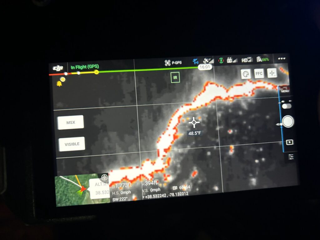
The Virginia Department of Forestry has integrated drones equipped with thermal imaging and high-resolution cameras into wildfire and forest health operations. These unmanned aircraft systems are used to monitor fire perimeters, assess conditions during prescribed burns, and support operations in areas where ground access is limited, improving both safety and efficiency.
Puerto Rico: Modernizing Equipment & Response
Puerto Rico significantly enhanced its wildfire response capacity through expanded cooperation with federal partners and the integration of modern equipment and technology tailored to the island’s extended wildfire annual wildfire activity. In 2025, the Puerto Rico Fire Department (PRFD) responded to 1,351 wildfires, impacting almost 9,000 acres. Due to the island’s geographic and climatic conditions, vegetative fuels remain highly susceptible to ignition from January through August, contributing to an annual average of approximately 3,000 wildfires and reinforcing the need for continued investment in wildfire technology and operational readiness.
PRFD strengthened its training, prevention, mitigation and response programs through collaboration with the USDA Forest Service’s Institute of Tropical Forestry (IITF), the National Weather Service, the Puerto Rico Department of Natural and Environmental Resources, and additional state and federal partners. These interagency efforts improved planning, operational coordination, resource sharing and fire monitoring. Joint initiatives will continue into 2026 under the Division of Homeland Security/Wildfires.
A centralized Base of Operations (Hub) coordinates wildland fire response, mitigation projects, and specialized operations, supported by five strategically located all‑hazard crews across the island. In 2025, six PRFD fire crews provided year‑round wildfire management and all‑hazard response, including:
- Delivering training and fire academies
- Conducting fuel mitigation through controlled burns and firebreak construction
- Supporting wildfire suppression and structure protection
- Integrating satellite‑based fire detection, monitoring, modeling, and data‑sharing technologies
These operations are supported by equipment and tools funded through the USDA Forest Service’s State and Volunteer Fire Assistance Program and the Community Wildland Fire Defense Grant, which have been essential in controlling fires, preventing spread, and protecting Puerto Rico’s natural resources.
U.S. Virgin Islands: Improving Access to Water with Floating Water Pumps
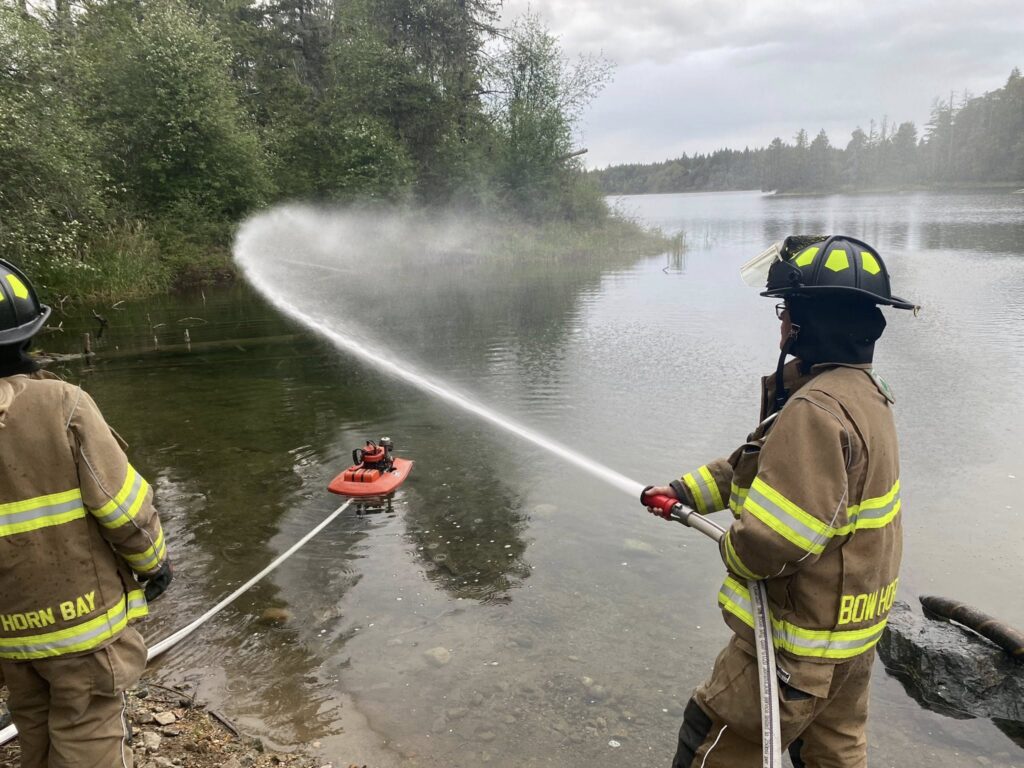
The U.S. Virgin Islands has enhanced wildfire suppression capacity by acquiring portable floating water pumps, improving access to water in areas where traditional infrastructure is limited. During Fiscal Year 2024, wildland firefighters in the territory responded to 47 wildland fires affecting more than 218 acres, using these tools to strengthen suppression effectiveness.
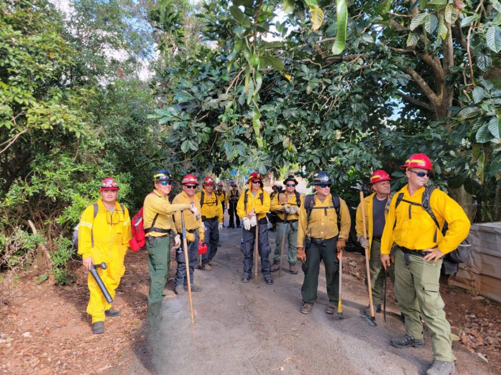
Training the Next Generation
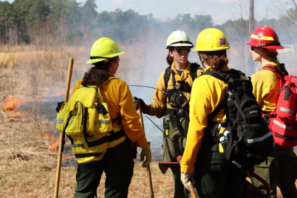
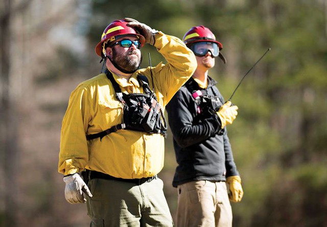
Southern state forestry agencies and their partners understand that technology is only as good as the skill and expertise of the people using it. That’s why southern state forestry agencies and their partners have invested heavily in comprehensive, innovative training programs that are developing the wildfire professionals of tomorrow. Across the region, state forestry agencies are building training capacity, creating educational partnerships, and ensuring their firefighters have access to the most current techniques and certifications. Below are some key examples of this in action across the Southern Region:
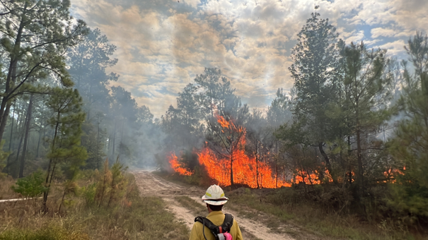
- Florida hosts the Interagency Prescribed Fire Training Center in Tallahassee, which serves as a regional hub bringing together federal, state, and local partners to ensure firefighters across the South have access to world-class education in prescribed fire techniques—a critical tool for reducing wildfire risk before fires start.
- Virginia Department of Forestry provides national-level training in wildfire suppression, all-hazard emergency response, and incident management, hosting an annual interagency wildland fire training academy that brings together hundreds of participants from across the region. The state’s commitment to training excellence helps maintain the highest level of expertise among Southern responders.
- In another example of regional collaboration, Tennessee and Kentucky have partnered to create the Tennessee & Kentucky Wildland Fire Academy, a multi-agency training academy held each January at the Tennessee Fire and Codes Academy in Bell Buckle, Tennessee. This joint effort provides specialized wildland fire training and demonstrates the power of cross-state collaboration in building firefighting capacity.
- Oklahoma State University has earned national recognition for its Fire Protection and Safety Engineering Technology program, which began in 1937 and has been declared by the National Fire Protection Association as the “Standard of Quality in the Profession.” The program serves students from across the South, with residents of Alabama, Arkansas, Georgia, Louisiana, Mississippi, South Carolina, Tennessee, Texas, and Virginia qualifying for in-state tuition through the Academic Common Market.
- One of the most innovative examples is the 1890 Land Grant Institution Wildland Fire Consortium, which partners federal agencies with historically Black colleges and universities including Florida A&M University, Southern University in Louisiana, Tuskegee University in Alabama, and Alabama A&M University. Known as the “FireDawgs,” students from these institutions are entering the wildland fire profession through specialized training programs that are diversifying and strengthening the Southern fire workforce.
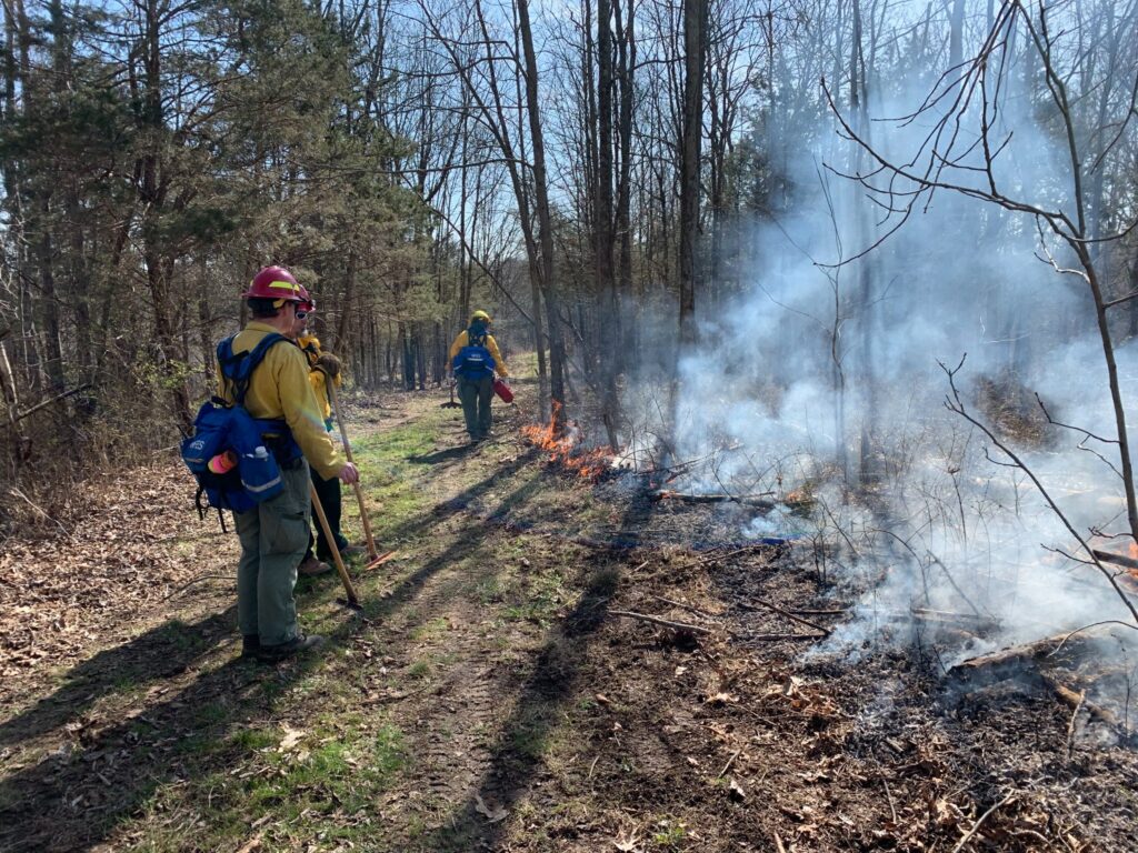
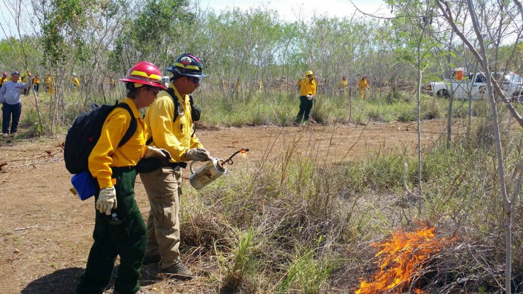
Many southern states also support prescribed fire councils and certified burner programs that provide landowners and land managers with high-level training and continuing education to safely and smartly conduct prescribed burns. These represent just a sampling of the training investments happening across the South, each of which maintains robust programs tailored to their unique landscapes and wildland fire challenges.
Looking Ahead
The South is prepared and remaining agile. Changing weather patterns, expanding wildland-urban interface and increasingly severe wildfire behavior mean today’s innovations are tomorrow’s necessities. Every day, southern wildland fire professionals are pushing the boundaries of what’s possible in wildfire management, not because it’s easy, but because protecting Southern communities, forests and economies demands nothing less. As wildfires grow more challenging, the South’s message is clear: We’re not just fighting harder. We’re fighting smarter. And we’re doing it together.